Google Maps update brings new health-related feature to Android and iOS

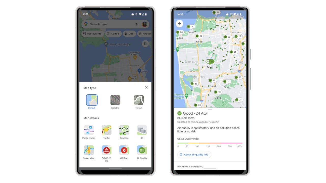
A new quality layer is now available on Google Maps for both Android and iOS users, along with information about when exactly the index was last updated. While we don’t know how accurate new feature really is, Google says that the air quality layer shows trusted data from government agencies, including the Environment Protection Agency in the United States.
Additionally, the Mountain View company mentions that Google Maps is also showing air quality information from PurpleAir, which is a low-cost sensor network that give a more focused view of conditions.
Google Maps users who want to check air quality must add the special layer to their maps by tapping on the button in the top right corner of the screen, and then selecting Air Quality under Map details.
At the same time, Google revealed that users can now view air quality information from PurpleAir on Nest displays and speakers. This is an important improvement since PurpleAir sensor have a broad coverage in the US, which means more people will be able to access this type of information directly from their Nest devices.
In related news, Google announced in addition to its partnership with the National Interagency Fire Center (NIFC) that allows Maps users to see more details about active fires in the area, it will add smoke data across the US from the National Oceanic and Atmospheric Administration to its air quality information on Google Search.
Kudos to Google for finally adding these new features, which will allow more people to understand how devastating pollution is for Earth and how close to extinction we really are.
For all the latest Technology News Click Here
For the latest news and updates, follow us on Google News.

