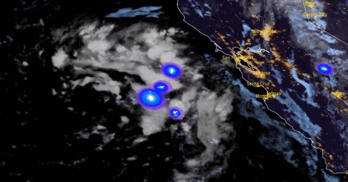
SAN FRANCISCO — A low pressure system spinning just off the Northern California coast was churning up thundershowers Tuesday morning with the threat of lightning strikes as it moves eastward over the Bay Area.
While there were blue skies over much of the region early Tuesday it wasn’t a reflection of what was going on offshore.
The system — spun off from the remnants of Typhoon Merbok — has been parked in the Pacific Ocean off Northern California ever since it moved down the coast late Saturday night.
It triggered a bout of rare heavy September rain on Sunday and popup thunderstorms in the East Bay on Tuesday.
“Showers and possibly thunderstorms will be possible again today into Wednesday morning as the low stays west of San Francisco,” according to the National Weather Service. “Another rain band is approximately 60 miles offshore and has produced a few lightning strikes in the last hour.”
Additional showers were also possible for the drought stricken region.
“There is a slight chance that these showers could produce some lightning and thunder with highest chances in the North Bay,” the weather service said. “The Storm Prediction Center has the North Bay under a mention of general thunderstorms again through Wednesday morning. With this last round of showers, another few hundredths to up to 0.25 inches is possible in the Bay Area through Wednesday morning, with highest amounts near the coast and in higher elevations in San Mateo County. “
Heavy rain fell Sunday across Marin, Napa and Sonoma counties north of San Francisco, with more than an inch recorded over 24 hours in some mountain areas, the weather service said.
However, only Oakland topped its record for rainfall on Sept. 18. Still any precipitation was surprising given that September is usually one of the driest months of the year.
“September is climatologically the third driest month of the year, thus forecast rain amounts on the order of a few tenths of an inch to 1 inch (locally 1-2 inches hills/mtns) compared to the 30-year Sept normals may easily reach 800% of normal in a lot of areas to near 1,000% in the North Bay,” the weather service said.
Unlike the storm that recently triggered mudslides and flooding in Southern California, this weather system also has no connection to the humid air of the tropics.
“What is highly unusual about this particular pattern is the lack of connection to the eastern Tropical Pacific since if we’re going to get rain/showers in September typically there’s some moisture connection or origin to the eastern Tropical Pacific since it’s only late astronomical summer and it’s too early for the larger scale southern shift in westerlies,” the weather service said. “But, this system is breaking through. “
This time of year, forecasters added: “Northwest arriving systems typically are a bit moisture starved.”
For all the latest Automobiles News Click Here
For the latest news and updates, follow us on Google News.

